
Instrument Support Level 6
Raymetrics LR111C-ESS-D300
£70
Calendar
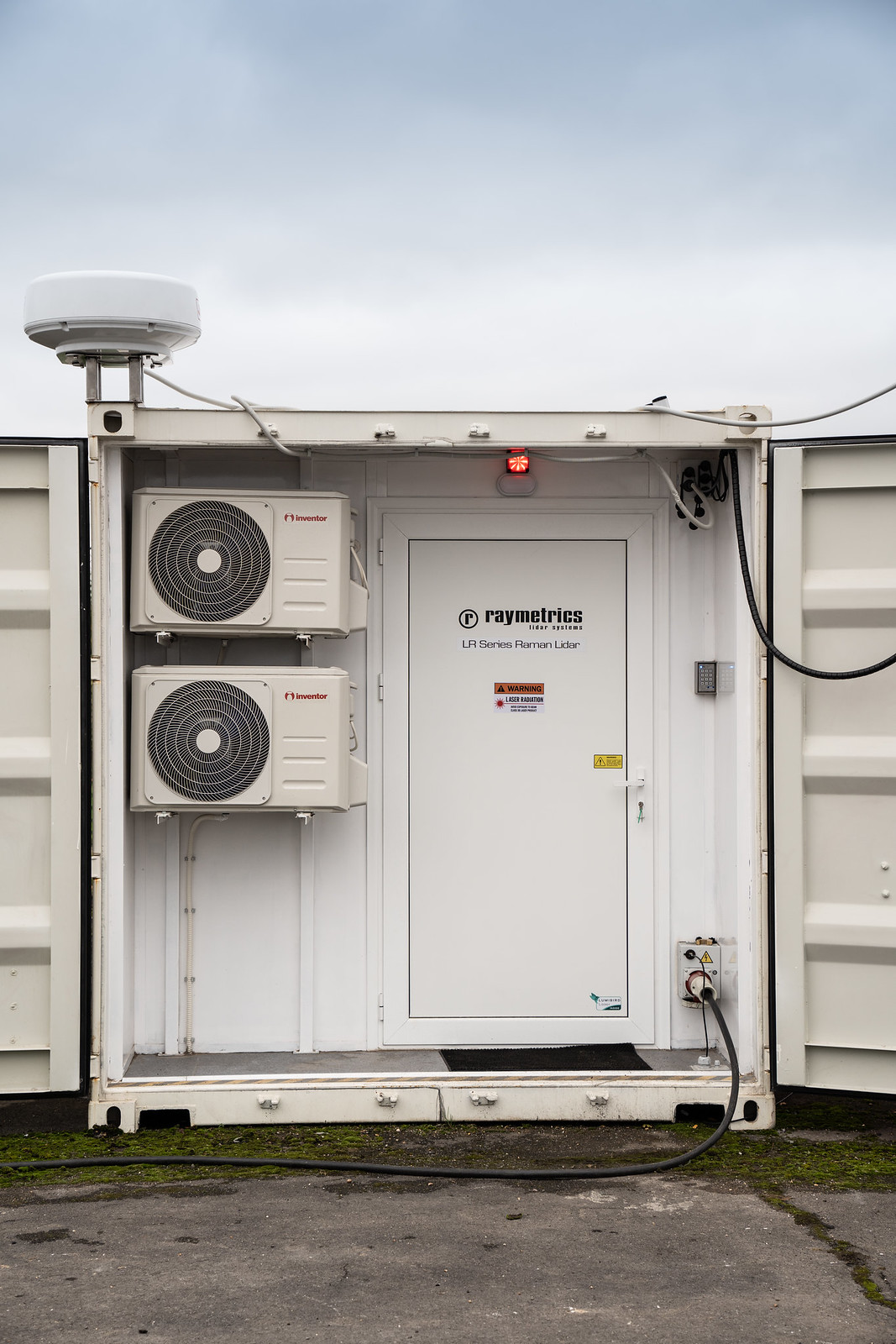
Raymetrics Raman Lidar
NOTE: As of 1 April 2026 this instrument will be relocated. More information will be updated in due course.
The Raymetrics LR111C-ESS-D300 lidar system is a state-of-the art instrument for measuring profiles of atmospheric aerosol. It transmits at 355 nm with a power of 64 mJ and a pulse repetition frequency (PRF) of 20 Hz. It has a far field telescope connected to 3 reception channels: 355 nm elastic, 355 nm depolarised and 387 nm nitrogen Raman backscatter. It incorporates features to allow alignment and calibration, and is compliant with the requirements of the Aerosol, Clouds and Trace Gases Research Infrastructure (ACTRIS).
The lidar is also upgradable and will hopefully be upgraded in the near future with the following options: a 407 nm water vapour channel, a 532 nm laser (with elastic, depolarisation and 607 nm nitrogen Raman backscatter channels), a near field telescope and a 1064 nm laser (with elastic and depolarisation channels).
The lidar typically operates to a regular schedule to allow delivery of data to the European Atmospheric Research Lidar Network (EARLINET). Users may request additional operation (e.g. continuous operation during a campaign), or tailored configurations outside the EARLINET schedule.
Atmospheric lidar systems are active remote sensing instruments that use lasers to measure the distance to and properties of the atmosphere.
In its simplest form, a lidar (LIght Detection And Ranging) system measures laser light that has scattered off targets (typically particles or molecules) in the atmosphere. It does this by transmitting laser pulses and using a receiver to capture the light that is scattered back. Using the time it takes for the laser light to travel to the target and back to the receiver it is also possible to calculate the distance or range of that target. The receiver generally has some electronics that can measure the intensity of the “back-scattered” light. This sort of lidar is generally used to measure the height and intensity of cloud or aerosol particles. More details on the operating principle can be found here.
The Raymetrics Raman Lidar is an advanced lidar system that operates in the ultraviolet. It uses a frequency-tripled Nd:YAG laser to create a laser beam with a wavelength of 355 nm. The laser pulses are transmitted into the atmosphere at an angle of 4 degrees off zenith. The backscattered light is split into three different receivers with filters to isolate the desired wavelength and remove any other wavelengths, eg. from sunlight:
- Co-polar elastic scattering
- Cross-polar elastic scattering
- Nitrogen Raman scattering
Channels (1) and (2) use a 355 nm filter to isolate the elastic backscatter (ie. scattering that doesn’t change the wavelength) of the laser beam from the light gathered by the telescope. This helps remove background light caused by sunlight, for example. The light is then passed through a beam splitter that separates out the different polarisations of the elastic backscatter: the (1) co-polar and (2) cross-polar components.
A laser beam is typically polarised. If laser light hits a target and the polarisation is unaffected, channel (1) would receive all of the light and channel (2) would receive nothing. Conversely, if the light was completely depolarised channels (1) and (2) would see the same amount of light. Typically, atmospheric particles and molecules will “depolarise” the light between these two extremes. The depolarisation ratio can be calculated by dividing channel (2) by channel (1).
The depolarisation ratio is useful as it can be used to identify the shape of aerosol and cloud particles. Typically, spherical particles have a very low depolarisation ratio (xx-yy%) whereas non-spherical particles have a high depolarisation ratio (>zz%).
Channel (3) uses a 387 nm filter to isolate inelastic backscatter (ie. scattering that changes the wavelength) caused by molecular nitrogen (N2) in the atmosphere. This is known as Raman scattering. Due to quantum mechanical effects, the light is absorbed by the particle at 355 nm and in this case the vibrational state of the molecule changes and the light is re-emitted at several different discrete wavelengths (including 387 nm). Channel (3) isolates this vibrational Raman scattering at 387 nm. This signal is light that originates from molecular nitrogen only. This is used as reference signal when calculating aerosol backscatter coefficient using channel (1). See here for more details.
The laser requires a flashlamp change after approximately 29 days of continuous operation. This is carried out by the on-site lidar technician. As the laser has to be removed for this purpose, the alignment of the system needs to be checked and calibrated after this procedure. This is carried out by an AMOF lidar scientist.
Therefore the instrument is typically calibrated approximately once a month. This procedure does, however, require clear skies, so the time period between calibrations can be longer.
The calibration procedure checks the alignment of the laser beam and adjusts if needed. It also checks the depolarisation system and corrects if necessary.
The lidar system is housed in a sea container on site and is protected by a number of different interlock systems that shut off the laser if there’s a risk of laser exposure. The user is not expected to interact physically with the lidar.
The data are currently stored in a native format. Work is ongoing to convert the data to an AMOF-standard NetCDF format. This will be made available through the CEDA Archive. Please contact the instrument scientist for more details.
The lidar is in the process of joining EARLINET. This network uses a system called the Single Calculus Chain (SCC). The SCC uses a single algorithm to process lidar data and can accept raw data from any lidar system. This means that the data from any system using the SCC can be compared with another.
The lidar typically operates to a regular schedule to deliver data compliant with EARLINET. These data are freely available to our users.